BP initiatives leverage robotics, advanced analytics to improve safety, enhance recovery in upstream operations

By Kelli Ainsworth Robinson, Associate Editor
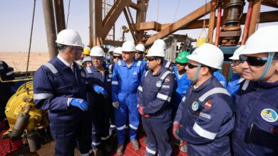
Advanced digital technologies – in the form of algorithms, digital twins, high-quality imaging and remote inspections, to name a few – have enabled BP to improve its reservoir understanding, take people out of harm’s way and work more efficiently. Last year, the company began using robotic drones and crawlers to perform riser inspections, eliminating the need for rope access inspections. Additionally, BP has developed a new low-frequency seismic acquisition service that can create a richer, more complete image of the subsurface and allow the operator to better place its wells. “We have a program running in BP that we call our modernization and transformation agenda,” Gordon Birrell, Chief Operations Officer for Upstream Production, said during a media briefing at the 2018 OTC in Houston on 1 May. “The program will make us more efficient, will automate more of what we do, will make us leaner and will allow us to make data-informed decisions.”
In 2017, BP ran a pilot project using drones and crawlers to perform riser inspections on its Thunderhorse project in the Gulf of Mexico. Historically, these inspections would have been performed via rope access, Starlee Sykes, Regional President, Gulf of Mexico and Canada, said. “It’s men and women on ropes hanging out over the water to inspect facilities that are hard to get to,” she said. “That puts people in harm’s way to do that work, but we’re now doing it with drones and crawlers.”
Both drones and crawlers are equipped with high-resolution cameras that can capture high-quality images. While drones capture these images from above, crawlers made with rare earth magnets can actually attach to the riser and move up, down and around it, Dave Truch, Technology Director, explained. While the safety benefits of using robots are obvious, BP has also found that robots can conduct inspections more quickly than humans can. He noted that BP has seen a 60-70% improvement in inspection efficiencies through the use of drones and crawlers.
To date, the drones and crawlers used for inspections have been remotely operated, but BP plans to make them autonomous eventually. “As we add more and more autonomy to these devices, they will be running the missions on their own,” he said. “Essentially, press the button and the collection mission will occur, so we won’t need as many individuals involved in the capture.” Having proved the concept on Thunderhorse, BP plans to roll out drone and crawler inspections across the Gulf of Mexico during subsequent inspections.
BP has also harnessed digital technologies and advanced analytics to improve subsurface imaging and, as a result, the company’s ability to identify reservoir targets. The operator has developed a new low-frequency seismic acquisition technology, WOLFSPAR. The device consists of a cone that generates low-frequency sound, which propagates through the water and is received by nodes on the ocean floor. Combining low-frequency waves with high-frequency waves provides a fuller, richer picture of the subsurface, Ahmed Hashmi, Global Head of Upstream Technology, said. BP sees the technology as a significant enabler in the Gulf of Mexico, where salt formations can obscure images of the oil and gas reservoirs below. “We’ve been on a journey to make salt in the Gulf of Mexico completely irrelevant through our imaging process, so see through salt as if it doesn’t exist,” Mr Hashmi said. BP has already used WOLFSPAR to conduct a survey in the Gulf of Mexico; results were still pending as of early May.
BP has also begun using full wave form inversion to analyze seismic images and data at the company’s Center for High-Performance Computing in Houston, Ms Skyes said. This technique has already enabled the operator to find an additional 1 billion bbls of oil-in-place in the Gulf of Mexico. Not only that, she added, but the company was able to identify these volumes quickly. “Work that now takes two weeks using the Center for High-Performance Computing and the algorithms that we’ve developed with the full wave form inversion technique would have taken 1,000 man-years with 20th-century super computers.”